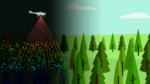
Fire risk assessment and management with ForestMap

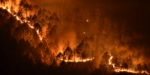
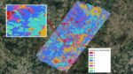
A new feature of ForestMap is the addition of a fire module, bringing the full potential of LiDAR to assess vegetation structure and thus to characterise the fuel model. The Prometheus model has been used for fuel classification in order to have a homogeneous classification applicable to all countries. Country-specific models will be used progressively, … Read more

Visit to Burgundy to showcase ForestMap

In July, we visited the Burgundy region (France), where we presented the functionalities of the ForestMap platform and made a field trip to some productive stands of Douglas fir where they are prospecting to buy timber. Taking advantage of this trip, we carried out a forest inventory test to validate our system in its real … Read more

ForestMap available in several languages

We are pleased to announce that the ForestMap platform is available in all the languages of the countries where we have carried out a pilot project: Slovenian, French, German, Finnish, Spanish, Portuguese, Italian, in addition to English. Anyone can access the platform, use it and get results from any of the areas we have inventoried … Read more

Meeting on 22 March, Lidar and remote sensing: opportunities for forestry and timber industry

Meeting on 22 March 2022 at 17.30 among forestry professionals on the practical applications of airborne Lidar and remote sensing (registration required) Hybrid format: Bordeaux Sciences Agro (Gradignan, 33) and online Context: With the Lidar HD programme, France is launching a national Lidar coverage project to provide a very precise 3D description of its territory; … Read more

FOWITA conference

From 13th to 15th September the FOWITA event will take place. It’s a forestry science conference that gives the public an overview of forestry research in German-speaking countries. It also serves as an exchange between forestry scientists across disciplinary boundaries. As in previous years, the presentations at FOWITA should reflect the amplitude of forest science … Read more

Forestry Fair Forexpo 2021

In a few days ForestMap will be presented at Forexpo, one of the most important forestry fairs in Europe. For this purpose, Agresta will have a stand at the service area (stand nº7) The fair will take place on the 22, 23 and 24 September in Mimizan, as usual, in the French Landes. (https://www.forexpo.fr/en/15-services.html) We … Read more

LiDAR inventory in the ForestMap pilot area in Portugal

The inventory of the pilot area in northern Portugal, covering about 12,900 ha in the municipalities of Mondim de Basto, Amarante and Celorico de Basto, is being finalised. We have preliminary results that we are checking, correcting and refining. After a data capture flight in June 2020, two field data collection campaigns were carried out, … Read more

Inventory pilot experience in the Terra de Lemos forest district (Lugo)

After a period of more than a year and a half of development, we have launched a pilot experience in the Terra de Lemos forest district, which has been chosen by Agresta to experiment with new developments and functionalities of the ForestMap platform. It is a prototype that is allowing us to validate its interest … Read more

Please, select a language to continue

english

English

spanish

Spanish

slovenian

Slovenian

germany

Germany

portuguese

Portuguese

finnish

Finnish

italian

Italian

french

French

·